Hasta 50% de dto en Historias para papá  Ver más

Enviar a
Montevideo, Montevideo
0
  • argentina
  • chile
  • colombia
  • españa
  • méxico
  • perú
  • estados unidos
  • internacional

Selecciona tu país

América

Europa

Resto del mundo

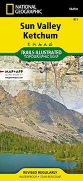
portada Sun Valley, Ketchum map (National Geographic Trails Illustrated Map, 871) (en Inglés)
Formato
Libro Físico
Idioma
Inglés
N° páginas
2
Encuadernación
Tapa Blanda
ISBN13
9781566958448
N° edición
2023rd

Sun Valley, Ketchum map (National Geographic Trails Illustrated Map, 871) (en Inglés)

National Geographic Maps (Autor) · Natl Geographic Society Maps · Tapa Blanda

Sun Valley, Ketchum map (National Geographic Trails Illustrated Map, 871) (en Inglés) - National Geographic Maps

Libro Nuevo Importado
Envío: 12 a 18 días háb.
$ 1.809$ 905
-50%
Costos de importación incluídos en el precio ✅
Libro Nuevo

Quedan 2 unidades

$ 905
Llega entre el 28 Jul y el 05 Ago a Montevideo, Montevideo. Seleccionar ubicación

Reseña del libro "Sun Valley, Ketchum map (National Geographic Trails Illustrated Map, 871) (en Inglés)"

- Waterproof - Tear-Resistant - Topographic MapSun Valley, a world-renowned ski resort, is surrounded by the scenic mountains of central Idaho and located within the Sawtooth National Forest. Nearby Ketchum, was the final home to the famous writer, Ernest Hemingway, who frequented the Sun Valley area to fish, hunt and write. Located in the Wood River Valley the towns of Sun Valley and Ketchum lead visitors into the wilds of the Pioneer, Smoky, Solider and Boulder mountain ranges and miles of trails popular for hiking, mountain biking, snowmobiling, and OHV use create endless opportunities for recreation.With hundreds of miles of mapped trails this map can guide you off the beaten path and back again in some of the most breathtaking scenery in the region. Trail mileages, trail use and seasonal closures will assist in choosing the path that's right for you. Recreation features are clearly marked, including campgrounds, trailheads, boat launches, ski areas, and other points of interest. The map base includes contour lines, shaded relief, and elevations for summits, passes and many lakes.Every Trails Illustrated map is printed on "Backcountry Tough" waterproof, tear-resistant paper. A full UTM grid is printed on the map to aid with GPS navigation.Map Scale = 1:75,000Sheet Size = 25.5" x 37.75"Folded Size = 4.25" x 9.25"

Opiniones del libro

Preguntas frecuentes sobre el libro

Todos los libros de nuestro catálogo son Originales.
El libro está escrito en Inglés.
La encuadernación de esta edición es Tapa Blanda.

Preguntas y respuestas sobre el libro

¿Tienes una pregunta sobre el libro? Inicia sesión para poder agregar tu propia pregunta.

Opiniones sobre Buscalibre

Ver más opiniones de clientes